


Washington & Ozaukee Counties PUMA, Wisconsin
About
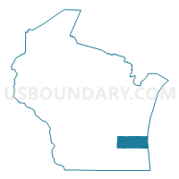
Outline

Summary
| Unique Area Identifier | 194412 |
| Name | Washington & Ozaukee Counties PUMA |
| State | Wisconsin |
| Area (square miles) | 1,551.92 |
| Land Area (square miles) | 663.78 |
| Water Area (square miles) | 888.14 |
| % of Land Area | 42.77 |
| % of Water Area | 57.23 |
| Latitude of the Internal Point | 43.35362800 |
| Longtitude of the Internal Point | -87.81039440 |
Maps

Graphs
Select a template below for downloading or customizing gragh for Washington & Ozaukee Counties PUMA, Wisconsin


Neighbors
Neighoring Public Use Microdata Area (by Name) Neighboring Public Use Microdata Area on the Map
- Dodge & Jefferson Counties PUMA, WI
- Fond du Lac & Calumet Counties PUMA, WI
- Milwaukee City (North) PUMA, WI
- Milwaukee County (Northeast) PUMA, WI
- Milwaukee County (South) PUMA, WI
- Muskegon County PUMA, MI
- Newaygo, Mason, Oceana & Lake Counties PUMA, MI
- Sheboygan County PUMA, WI
- Waukesha County (Central) PUMA, WI
- Waukesha County (East) PUMA, WI
- Waukesha County (West) PUMA, WI
Top 10 Neighboring County (by Population) Neighboring County on the Map
- Milwaukee County, WI (947,735)
- Waukesha County, WI (389,891)
- Muskegon County, MI (172,188)
- Washington County, WI (131,887)
- Sheboygan County, WI (115,507)
- Fond du Lac County, WI (101,633)
- Dodge County, WI (88,759)
- Ozaukee County, WI (86,395)
- Oceana County, MI (26,570)
Top 10 Neighboring County Subdivision (by Population) Neighboring County Subdivision on the Map
- Milwaukee city, Milwaukee County, WI (594,833)
- Menomonee Falls village, Waukesha County, WI (35,626)
- West Bend city, Washington County, WI (31,078)
- Mequon city, Ozaukee County, WI (23,132)
- Germantown village, Washington County, WI (19,749)
- Hartford city, Washington County, WI (14,223)
- Brown Deer village, Milwaukee County, WI (11,999)
- Grafton village, Ozaukee County, WI (11,459)
- Cedarburg city, Ozaukee County, WI (11,412)
- Richfield village, Washington County, WI (11,300)
Top 10 Neighboring Place (by Population) Neighboring Place on the Map
- Milwaukee city, WI (594,833)
- Menomonee Falls village, WI (35,626)
- West Bend city, WI (31,078)
- Mequon city, WI (23,132)
- Germantown village, WI (19,749)
- Hartford city, WI (14,223)
- Brown Deer village, WI (11,999)
- Grafton village, WI (11,459)
- Cedarburg city, WI (11,412)
- Richfield village, WI (11,300)
Top 10 Neighboring Elementary School District (by Population) Neighboring Elementary School District on the Map
- Hartford Joint No. 1 School District, WI (17,741)
- Fox Point Joint No. 2 School District, WI (11,001)
- Merton Community School District, WI (6,522)
- Richfield Joint No. 1 School District, WI (4,599)
- North Lake School District, WI (2,769)
- Stone Bank School District, WI (2,647)
- Erin School District, WI (2,530)
- Friess Lake School District, WI (2,223)
- Maple Dale-Indian Hill School District, WI (1,807)
- Herman No. 22 School District, WI (1,798)
Top 10 Neighboring Secondary School District (by Population) Neighboring Secondary School District on the Map
- Arrowhead Union High School District, WI (33,805)
- Hartford Union High School District, WI (31,920)
- Nicolet Union High School District, WI (25,470)
Top 10 Neighboring Unified School District (by Population) Neighboring Unified School District on the Map
- Milwaukee School District, WI (594,784)
- West Bend School District, WI (51,553)
- Oconomowoc Area School District, WI (33,538)
- Menomonee Falls School District, WI (28,932)
- Mequon-Thiensville School District, WI (26,456)
- Hamilton School District, WI (25,915)
- Germantown School District, WI (25,684)
- Cedarburg School District, WI (20,142)
- Port Washington-Saukville School District, WI (17,238)
- Slinger School District, WI (15,694)
Top 10 Neighboring State Legislative District Lower Chamber (by Population) Neighboring State Legislative District Lower Chamber on the Map
- State House District 91, MI (90,216)
- State House District 100, MI (86,569)
- Assembly District 99, WI (63,750)
- Assembly District 58, WI (60,111)
- Assembly District 38, WI (59,797)
- Assembly District 59, WI (58,836)
- Assembly District 60, WI (57,434)
- Assembly District 24, WI (57,065)
- Assembly District 39, WI (56,515)
- Assembly District 23, WI (55,249)
Top 10 Neighboring State Legislative District Upper Chamber (by Population) Neighboring State Legislative District Upper Chamber on the Map
- State Senate District 34, MI (275,923)
- State Senate District 33, WI (177,499)
- State Senate District 20, WI (176,381)
- State Senate District 13, WI (175,277)
- State Senate District 8, WI (165,331)
Top 10 Neighboring 111th Congressional District (by Population) Neighboring 111th Congressional District on the Map
- Congressional District 5, WI (707,580)
- Congressional District 6, WI (705,102)
- Congressional District 2, MI (698,831)
- Congressional District 4, WI (669,015)
Top 10 Neighboring Census Tract (by Population) Neighboring Census Tract on the Map
- Census Tract 6402, Ozaukee County, WI (7,790)
- Census Tract 113, Sheboygan County, WI (7,121)
- Census Tract 2035, Waukesha County, WI (6,563)
- Census Tract 6501.01, Ozaukee County, WI (6,516)
- Census Tract 2034.06, Waukesha County, WI (6,425)
- Census Tract 4702.02, Washington County, WI (6,278)
- Census Tract 4501.04, Washington County, WI (6,264)
- Census Tract 4601.01, Washington County, WI (6,262)
- Census Tract 422, Fond du Lac County, WI (6,115)
- Census Tract 6201, Ozaukee County, WI (6,079)
Top 10 Neighboring 5-Digit ZIP Code Tabulation Area (by Population) Neighboring 5-Digit ZIP Code Tabulation Area on the Map
- 53209, WI (46,917)
- 53051, WI (35,651)
- 53066, WI (33,830)
- 53223, WI (29,230)
- 53217, WI (29,192)
- 53095, WI (27,139)
- 53027, WI (22,041)
- 53090, WI (21,873)
- 53224, WI (21,284)
- 53029, WI (20,799)